Selecting microwindows for new nominal mode operations
which employ floating altitude grid (lowest altitude 3-9km from pole-equator)
and 1.5km spacing at lower altitudes (note that this is slightly different
from the latest definition of the nominal mode described in
Mission_Plan_V4.2.pdf)
- MWs for key species complete, now starting on additional species
which will useful for HiRDLS validation: CFC-11, CFC-12, N2O5 and ClONO2.
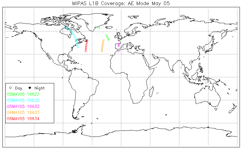
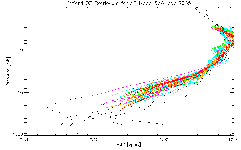
Aircraft Emission Mode (AD)
[Prev]
[Next]
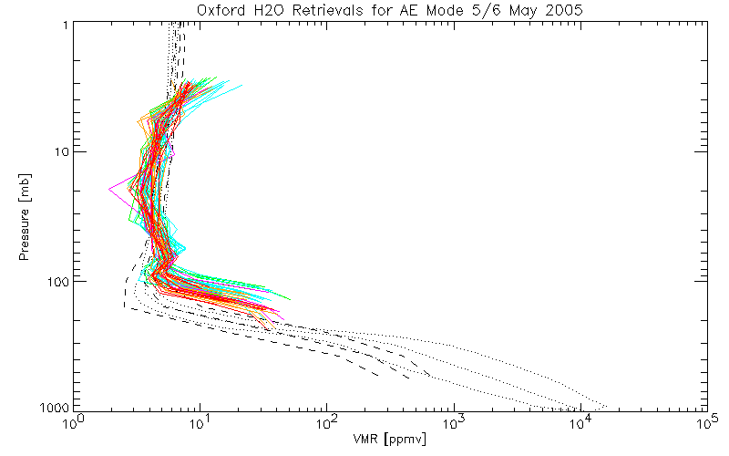
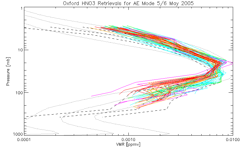
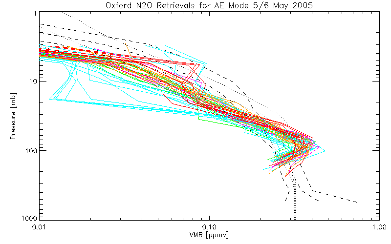
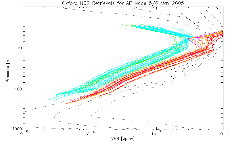
Sideways-viewing L1B data from "Aircraft Emission Mode" measurements
taken 5/6 May 05 have been processed by ESRIN for analysis.
- Plot of Profile Locations (NB: all day-time
at the tangent point)
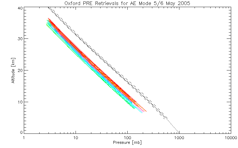
- An initial observation was that the range of altitudes reported in the L1B
data (5-36km) are approximately 2km below the 7-38km range described in the
Mission_Plan_V4.2.pdf
- However, the retrieved pressures (using MORSE,
shown by coloured lines, one per profile) suggest that the actual tangent
points are about 5km higher than the L1B values, ie 10-41km. (The dotted
lines are climatological alt v press, dashed lines are those retrieved
from MIPAS OFL data May 2003 for 20N-65N, central lines are mean while
outer lines are +/-1 sigma).
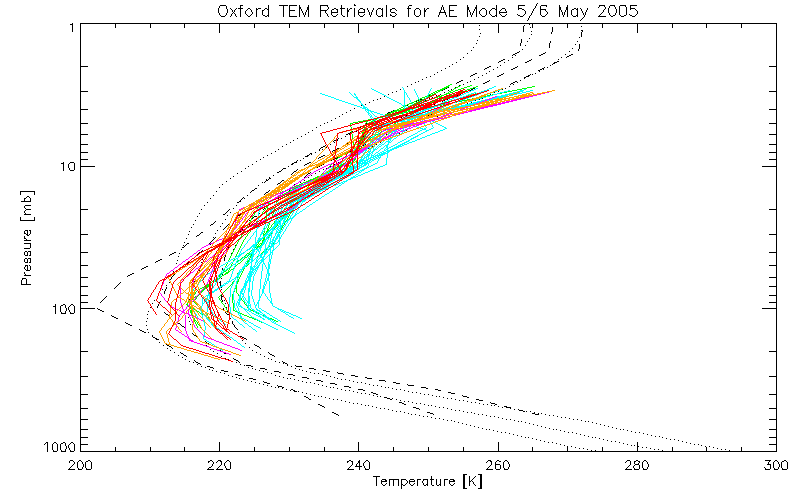
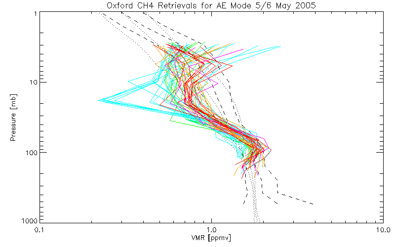
- Plotting against tangent pressure rather than altitude,
the Temperatures are a few K higher than expected while
the constituents (
CH4,
H2O,
HNO3,
N2O,
NO2,
O3) are slightly higher, which may indicate a calibration
problem.

