The Advanced Visible High Resolution Radiometer (AVHRR) Series
AVHRR Instruments, Operational Period and Satellite Platform
The AVHRR instrument series, is composed of the 15 instruments listed in Table 1.
The series began in 1978 and offers the longest available time record of multi-spectral data suitable for advanced retrievals.
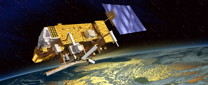
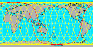
POES satellites have polar orbits at a relatively low orbit of 830 to 870 km above the Earth. They circle the earth 14 times per day allowing for complete global coverage twice per day. The AVHRR sensor is active on two satellites in opposite orbits; one ascending, one descending. This double coverage ensures that every place on Earth is observed every six hours.
Table 1: AVHRR Instrument Series
Morning or 'AM' Satellite
| Instrument | Operational Period | Platform |
|---|
| AVHRR | Jun 1979 – Nov 1986 | NOAA-6 |
| AVHRR | May 1983 – Oct 1985 | NOAA-8 |
| AVHRR | Nov 1986 – Sep 1991 | NOAA-10 |
| AVHRR/2 | May 1991 – Dec 1994 | NOAA-12 |
| AVHRR/3 | May 1998 – Present | NOAA-15 |
| AVHRR/3 | Jun 2002 – Apr 2013 | NOAA-17 |
| AVHRR/3 | Jun 2007 – Present | MetOp-A |
| AVHRR/3 | Apr 2013 – Present | MetOp-B |
|
|
Afternoon or 'PM' Satellite
| Instrument | Operational Period | Platform |
|---|
| AVHRR | Oct 1978 – Jan 1980 | TIROS-N |
| AVHRR/2 | Aug 1981 – Jun 1986 | NOAA-7 |
| AVHRR/2 | Feb 1985 – May 1994 | NOAA-9 |
| AVHRR/2 | Nov 1988 – Sep 1994 | NOAA-11 |
| AVHRR/2 | Dec 1994 – May 2007 | NOAA-14 |
| AVHRR/3 | Sep 2000 – Jun 2014 | NOAA-16 |
| AVHRR/3 | Aug 2005 – Present | NOAA-18 |
| AVHRR/3 | Jun 2009 – Present | NOAA-19 |
|
AVHRR Principles and Sensing Characteristics
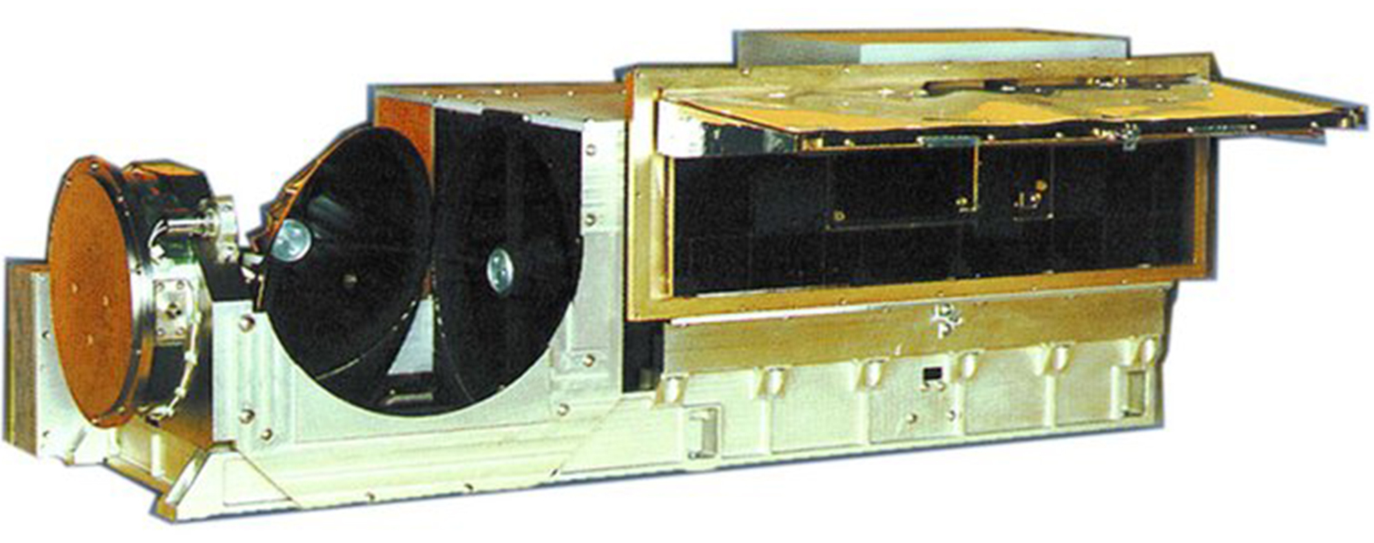
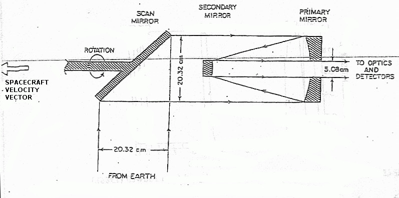
The AVHRR consists of a scanning mirror rotating at 360 revolutions per minute with its
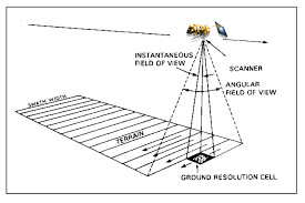
rotation axis aligned to the satellite's direction vector. The orientation of the scan lines are perpendicular to the spacecraft orbit track and the speed of rotation of the scan mirror is selected so that adjacent scan lines are contiguous at the sub-satellite (nadir) position. A total of 2048 samples are obtained per channel per Earth scan, which spans an angle of 55.4 degrees from the nadir (sub-point view).
Radiation reflected from the mirror is
divided into its visible and infrared components using a gold dichroic beam splitter. The two beams are further focused and filtered to provide the five or six spectral
channels listed in Table 2. The spectral channels of the AVHRR are registered so that they all measure energy from the same spot on the earth at the same time.
The optical system is designed so that the field-of-view (1.3 milliradians × 1.3 milliradians) equates to about 1.1 km × 1.1 km at the Earth's surface.
Table 2: AVHRR Channel Characteristics
AVHRR
| Channel | Wavelength Range (μm) |
|---|
| 1 | 0.58 - 0.68 |
| 2 | 0.725-0.98 |
| 3 | 3.56 - 3.94 |
| 4 | 10.5 - 11.5 |
|
|
AVHRR/2
| Channel | Wavelength Range (μm) |
|---|
| 1 | 0.58 - 0.68 |
| 2 | 0.725-1.10 |
| 3 | 3.55 - 3.93 |
| 4 | 10.3 - 11.3 |
| 5 | 11.5 - 12.5 |
|
AVHRR/3
| Channel | Wavelength Range (μm) |
|---|
| 1 | 0.58 - 0.68 |
| 2 | 0.725-1.00 |
| 3A | 1.58 - 1.64 |
| 3B | 3.55 - 3.93 |
| 4 | 10.3 - 11.3 |
| 5 | 11.5 - 12.5 |
|
How EODG Uses AVHRR
EODG uses AVHRR radiances as input to the Optimal Retrieval of Aerosol and Cloud (ORAC) algorithm. This code estimates aerosol, cloud and surface properties (depending upon the state of the atmosphere) which are used in both process and climatological studies. For example the long term record of AVHRR data can be used to see how the Earth's atmosphere is responding to elevated levels of CO2 and so address questions such as: "is the amount of cloud changing?", and "How are cloud properties changed by anthropogenic pollution?".
Publications
Grainger, R. G., The calculation of cloud parameters from AVHRR data, 1990.
McGarragh, G.R., C.A. Poulsen, G.E. Thomas, A.C. Povey, O. Sus, S. Stapelberg, C. Schlundt, S. Proud, M.W. Christensen, M. Stengel, R. Hollmann and R.G. Grainger,
The Community Cloud retrieval for CLimate (CC4CL) – Part 2: The optimal estimation approach,
Atmospheric Measurement Techniques, 11, 3397–3431, 2018.
Sus, O., M. Stengel, S. Stapelberg, G.R. McGarragh, C.A. Poulsen, A.C. Povey, C. Schlundt, G.E. Thomas, M.W. Christensen, S. Proud, M. Jerg, R.G. Grainger and R. Hollmann,
The Community Cloud retrieval for CLimate (CC4CL) – Part 1: A framework applied to multiple satellite imaging sensors,
Atmospheric Measurement Techniques, 11, 3373–3396, 2018.
External Links
AVHRR-Pathfinder
References
Kidwell, Katherine B., comp. and ed., 1995, NOAA Polar Orbiter Data (TIROS-N, NOAA-6, NOAA-7, NOAA-8, NOAA-9, NOAA-10, NOAA-11, NOAA-12, and NOAA-14) Users Guide : Washington, D.C., NOAA/NESDIS.
